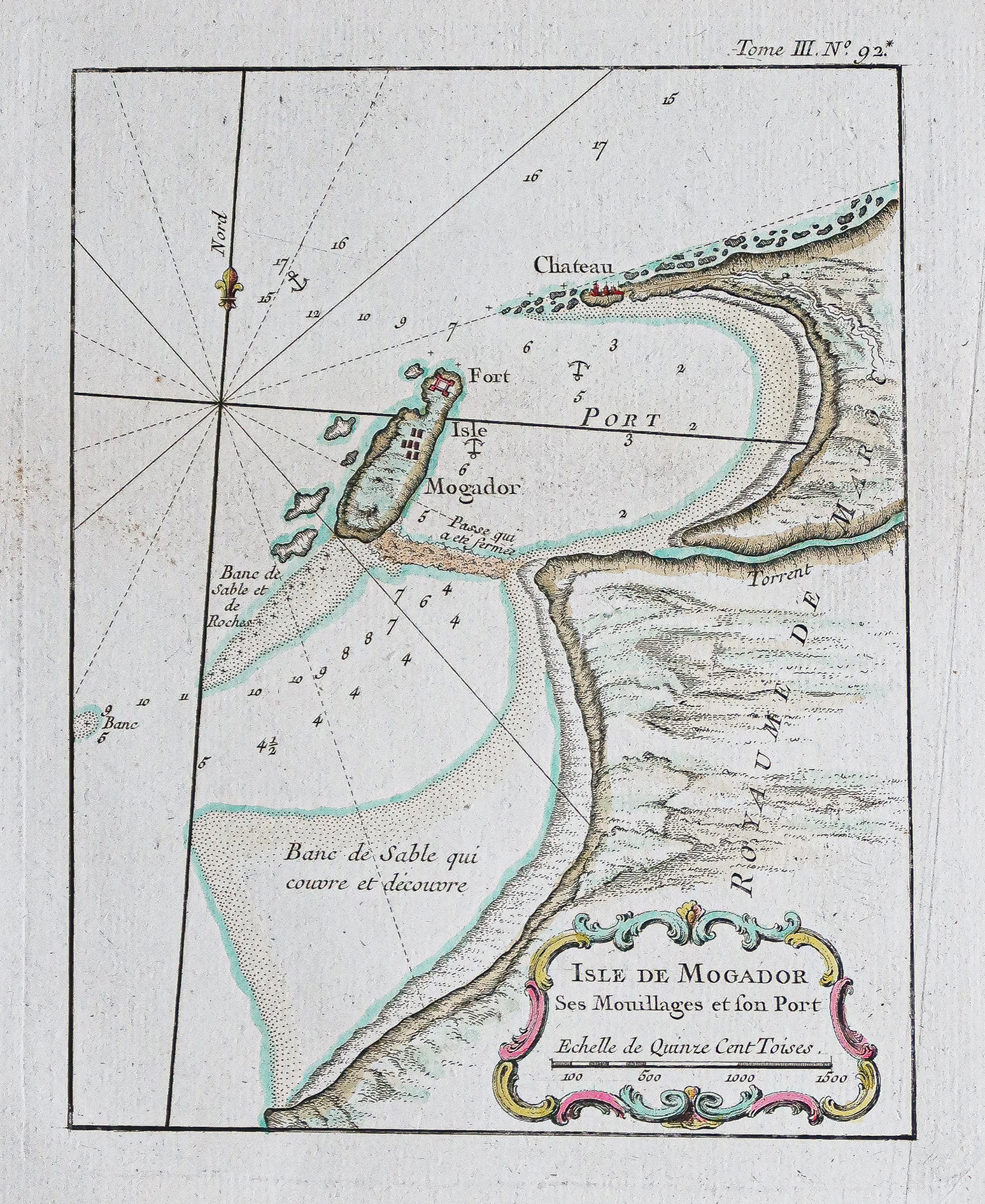
Carte ancienne de l’Île de Mogador – Essaouira
An original antique map from around 1750 by Bellin. The map includes a compass, scale, and underwater depth measurements. It measures 34x26 cm and the nautical chart part is 24x18.5 cm.
- The map is described as uncommon.
AI Readiness
Good foundation, but some important product data is still missing.
75%