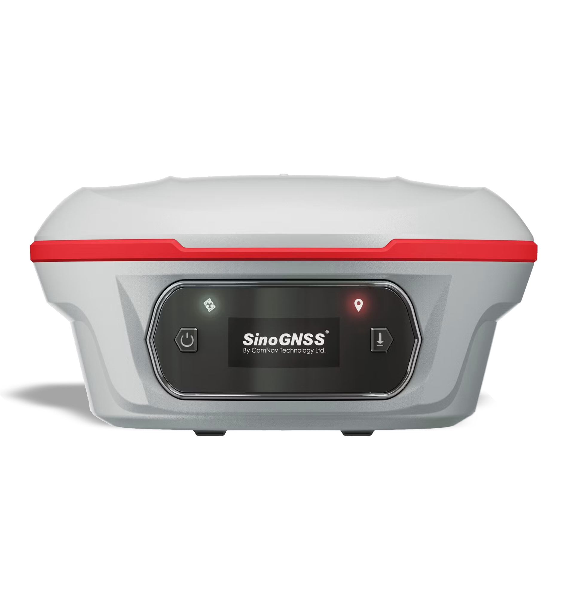
Jupiter Laser RTK
The SinoGNSS Jupiter Laser RTK is a high-end GNSS surveying receiver that combines multi-constellation GNSS, IMU tilt compensation, laser measurement, and dual-camera visual stakeout in one unit. It is designed for topographic surveying, construction layout/stakeout, points that are difficult to occupy with a range pole, and work in areas where conventional GNSS positioning is challenging. Key Features 1,668-channel K8 GNSS engine for multi-constellation, multi-frequency satellite tracking. Full GNSS constellation support: GPS, BDS, GLONASS, Galileo, QZSS, IRNSS and SBAS. Auto-IMU tilt survey — up to 120° tilt compensation, with approximately 2.5 cm accuracy in conventional tilt mode. Integrated 50 m laser for measuring points that are difficult or unsafe to occupy directly with a pole. Laser accuracy: approximately 3–5 mm + 1 ppm at room temperature. Dual-camera visual stakeout provides a visual 3D view and helps operators locate and stake points without repeatedly moving the pole. PPP support, including BDS B2b and Galileo HAS, subject to service/configuration availability. Super Datalink/UHF with up to 15 km working range under ideal conditions using SNLonglink. OLED color display for quick monitoring of satellites, RTK status and battery. IP67/IP68-rated protection depending on the current specification/version; the latest manufacturer material lists IP67/IP68 inconsistently, so I would verify the exact rating of the unit being quoted. Android 12 platform and 8-core processor in the current Jupiter package. Main Technical Specifications Specification Jupiter Laser RTK GNSS Channels 1,668 GNSS GPS, BDS, GLONASS, Galileo, QZSS, IRNSS, SBAS RTK Initialization <5 sec (baseline ≤10 km) Initialization Reliability ≥99.99% Data Update Rate 1 / 2 / 5 / 10 / 20 Hz Static/Fast Static H 2.5 mm + 0.5 ppm RMS Static/Fast Static V 5 mm + 0.5 ppm RMS Long Observation Static H 3.0 mm + 0.1 ppm RMS Long Observation Static V 3.5 mm + 0.4 ppm RMS RTK H 8 mm + 1 ppm RMS RTK V 15 mm + 1 ppm RMS Standalone 1.5 m 3D RMS IMU Tilt Up to 120° IMU Tilt Accuracy Approx. 2.5 cm Laser Range 50 m Laser Accuracy 3–5 mm + 1 ppm Laser Frequency 3 Hz typical / 5 Hz maximum Laser Tilt Measurement ≤3.5 cm at 5 m, ≤60° tilt UHF Frequency 410–470 MHz UHF Transmit Power 0.5 / 1 / 2 W adjustable UHF Range 3–15 km, depending on environment/protocol Wi-Fi 802.11 a/b/g/n, 5 GHz Bluetooth Bluetooth 4.0 Battery 7.2 V, 5,000 mAh Li-ion Operating Time Approx. 16 hours Memory 4 GB Interface USB Type-C Weight Approx. 810 g, including battery Dimensions Ø13.35 × 6.6 cm Display 1.1″ OLED color display Housing Aluminum-magnesium alloy Operating Temperature −40°C to +65°C Storage Temperature −40°C to +85°C Shock Resistance 2 m drop onto concrete Laser Safety Class 3R Cameras 2 × 2 MP global shutter Camera FOV 75° Camera Frame Rate 30 fps Typical Applications Jupiter Laser RTK is particularly suitable for: Topographic surveys Land surveying Construction surveying Road and infrastructure projects Building layout Stakeout Utility surveys Surveying near obstacles Points that are dangerous or difficult to occupy Stockpile and earthwork surveys GIS/data collection Cadastral-related fieldwork Surveying in areas where visual stakeout is advantageous
How AI sees this product
The more complete this product's details, the more confidently AI assistants can understand and recommend it.