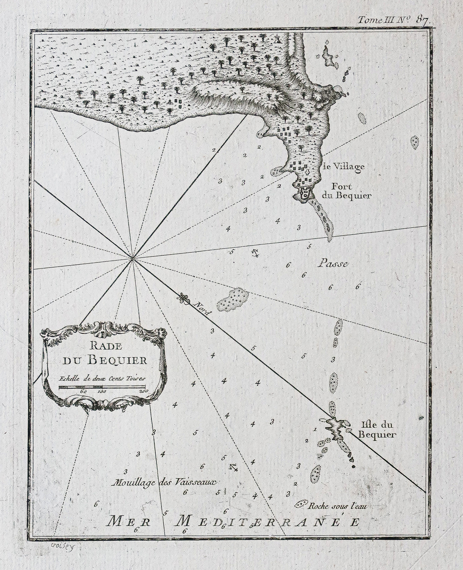
Plan ancien d’Abou Qir – Egypte
This original 18th-century map depicts the Abou Qir Bay area near Alexandria, Egypt, focusing on coastal features, forts, and the Béquier Island, including navigational aids and defensive structures.
- Illustrates the region’s coastal features and defensive structures important for navigation and defense in the 18th century.
AI Readiness
Good foundation, but some important product data is still missing.
75%