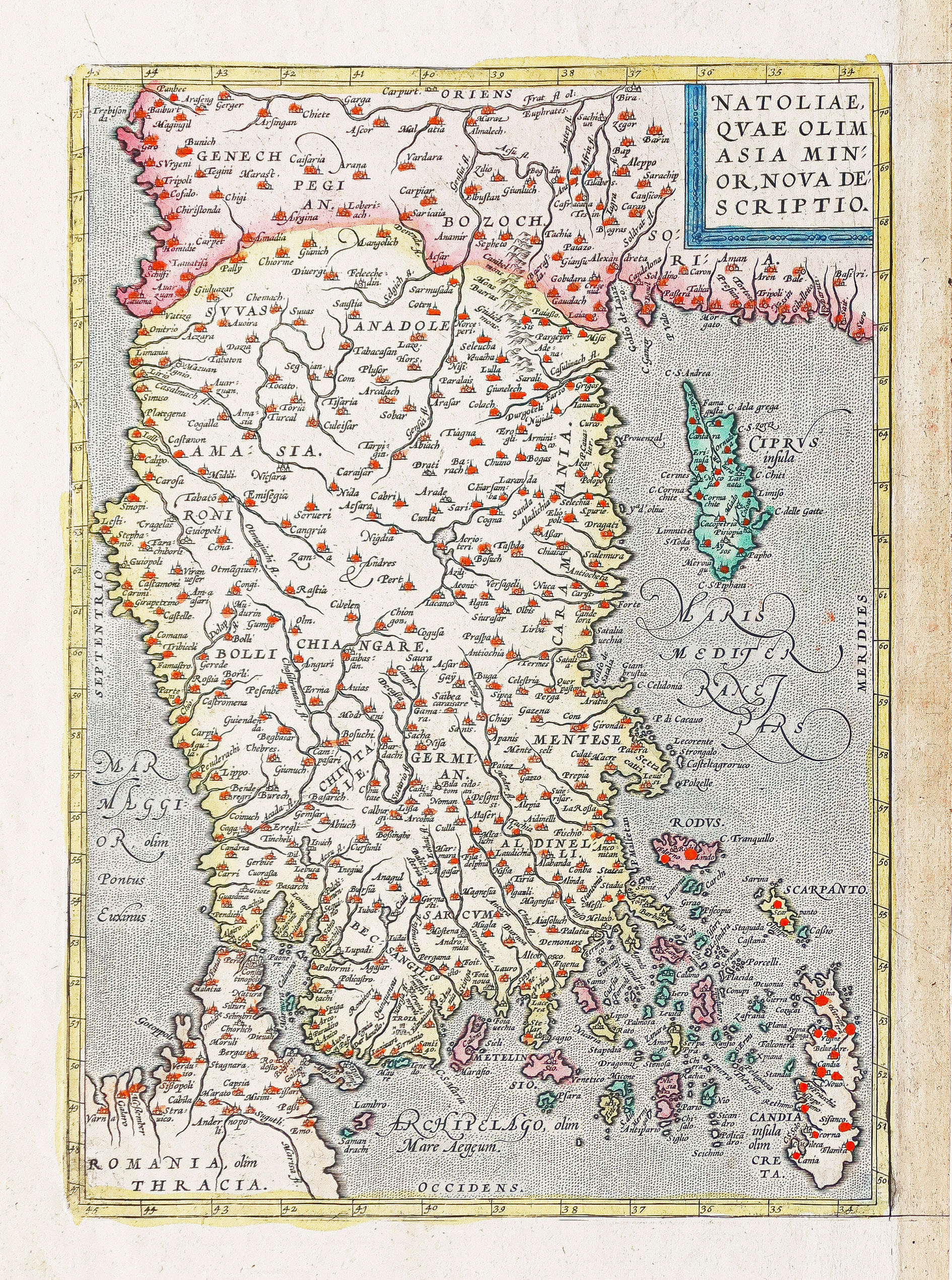
Carte géographique ancienne – Anatolie – Turquie
An original map from around 1580 by Abraham Ortelius, depicting Asia Minor, Cyprus, and the eastern Mediterranean, based on earlier maps.
- The description claims the map was published by Abraham Ortelius.
AI Readiness
Good foundation, but some important product data is still missing.
75%