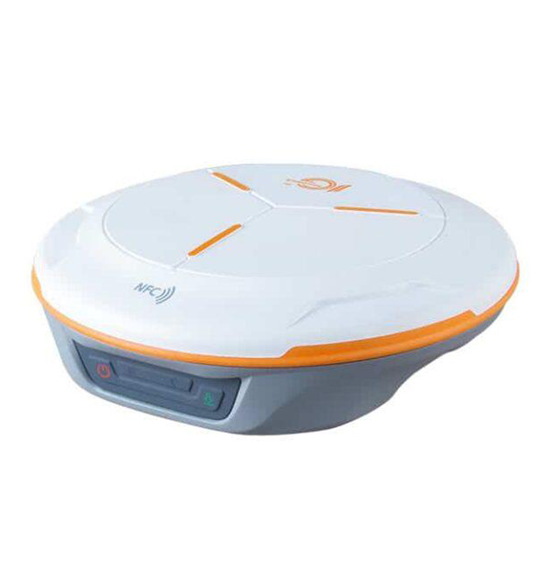
N2 Palm GNSS Receiver
The N2 Palm is a slim and lightweight GNSS RTK receiver featuring 1,590 channels and support for multiple global satellite constellations. Its compact 48 mm-thick body and approximately 670–720 g weight make it convenient for all-day field surveying. It supports Static, Fast Static, PPK and RTK surveying, while its integrated IMU provides tilt surveying up to 60° with approximately 2.5 cm accuracy, allowing surveyors to measure points without keeping the pole perfectly vertical. Key Features 1,590 GNSS channels Multi-constellation and multi-frequency GNSS tracking GPS, BeiDou, GLONASS, Galileo, QZSS, IRNSS and SBAS IMU tilt compensation up to 60° Tilt-survey accuracy: 2.5 cm Supports RTK, PPK, Static and Fast Static Integrated 4G LTE modem Integrated 410–470 MHz UHF radio UHF transmit power adjustable from 0.5 W / 1 W / 2 W UHF working range up to 15 km under ideal conditions Bluetooth 5.0 Dual Mode USB Type-C Up to 20+ hours operating time IP67 waterproof and dustproof Survives a 2 m drop onto concrete Android-compatible field data collection Supports CAD import and stakeout workflows RINEX and ComNav raw-data support Technical Specifications Specification SinoGNSS N2 Palm GNSS Channels 1,590 GPS L1C/A, L1C, L2P, L2C, L5 BeiDou (BDS) B1I, B2I, B3I, B1C, B2a, B2b GLONASS G1, G2, G3 Galileo E1, E5a, E5b, E6c, E5 AltBOC QZSS L1C/A, L2C, L5, L1C IRNSS L5 SBAS L1C/A RTK Initialization ≤10 seconds Signal Re-acquisition ≤1 second RTK Horizontal Accuracy 8 mm + 1 ppm RTK Vertical Accuracy 15 mm + 1 ppm Static/Fast Static Horizontal 2.5 mm + 0.5 ppm Static/Fast Static Vertical 5 mm + 0.5 ppm Long Observation Static Horizontal 3 mm + 0.1 ppm Long Observation Static Vertical 3.5 mm + 0.4 ppm DGPS Accuracy <0.4 m RMS SBAS Accuracy 1 m 3D RMS* Standalone Accuracy 1.5 m 3D RMS Tilt Survey Up to 60°, 2.5 cm accuracy Update Rate 1 / 2 / 5 / 10 Hz Internal Memory 8 GB; 16/32 GB options cited in documentation Bluetooth Bluetooth 5.0 Dual Mode UHF Frequency 410–470 MHz UHF Power 0.5 W / 1 W / 2 W adjustable UHF Range Up to 15 km in ideal conditions 4G LTE-FDD / LTE-TDD / WCDMA / GSM USB Type-C Pole Interface 5/8″ UNC female thread UHF Connector TNC Housing Magnesium-aluminum alloy Dimensions Ø149 ±1 mm × 48 ±1 mm Weight About 670 g Operating Temperature -30°C to +65°C Storage Temperature -40°C to +85°C Water/Dust Protection IP67 Drop Resistance 2 m onto concrete Charging Time <5 hours with QC2.0 Operating Time ≥20 hours Power Consumption RX ≤1.8 W; TX ≤3.6 W Main Applications The N2 Palm can be used for: Topographic surveying Land and cadastral surveying Construction surveying Road and infrastructure surveys Boundary surveys Stakeout GIS data collection Mapping RTK base/rover operations Static and PPK surveys Precision agriculture Marine surveying Machine-control applications Communication & Data The N2 supports RTCM 2.x/3.x and CMR/CMR+ correction formats and can output standard NMEA-0183 messages. ComNav Binary output can reach 20 Hz. It can also record GNSS observation data in RINEX and ComNav Raw Binary formats for post-processing. The associated software supports static and kinematic processing and can produce reports in formats including DXF, TXT and KML. Supported Software Survey Master Android-based field data collection Survey and stakeout workflows CAD import Surface stakeout and mapping survey MicroSurvey FieldGenius Android and Windows field data collection options SinoGNSS Compass GNSS post-processing Static and kinematic processing RINEX/raw-data processing DXF, TXT and KML output DJI P4R data compatibility is also documented.
How AI sees this product
The more complete this product's details, the more confidently AI assistants can understand and recommend it.