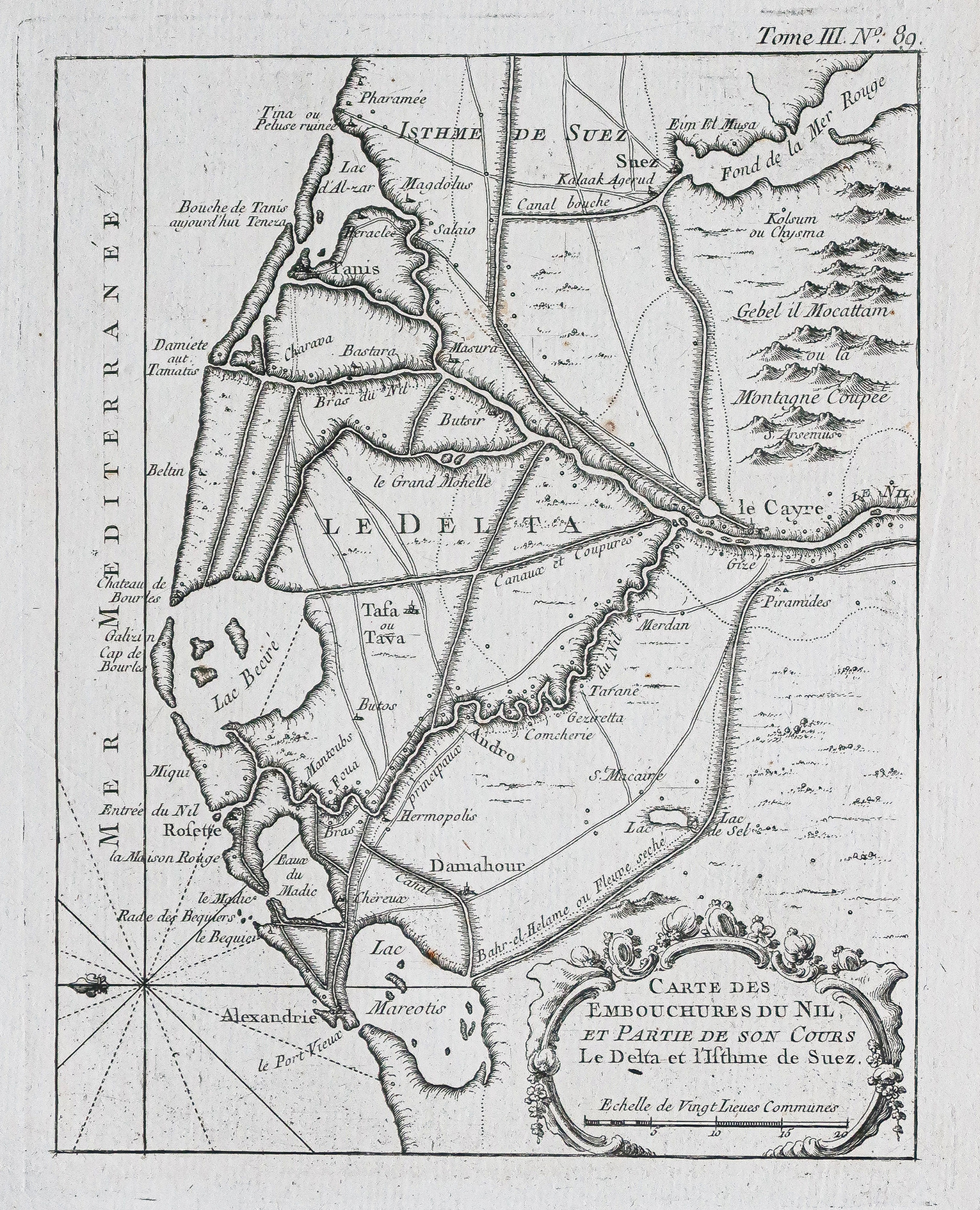
Carte ancienne des embouchures du Nil – Egypte
An original antique map from around 1750 by Bellin. The map measures 34x26 cm, with a 24x18.5 cm engraving. It shows a compass and scale of places. There are some light browning in the right margin and old rubbing near the compass.
- The map shows a compass and scale of places.
- There are some light browning in the right margin and old rubbing near the compass.
AI Readiness
Good foundation, but some important product data is still missing.
75%