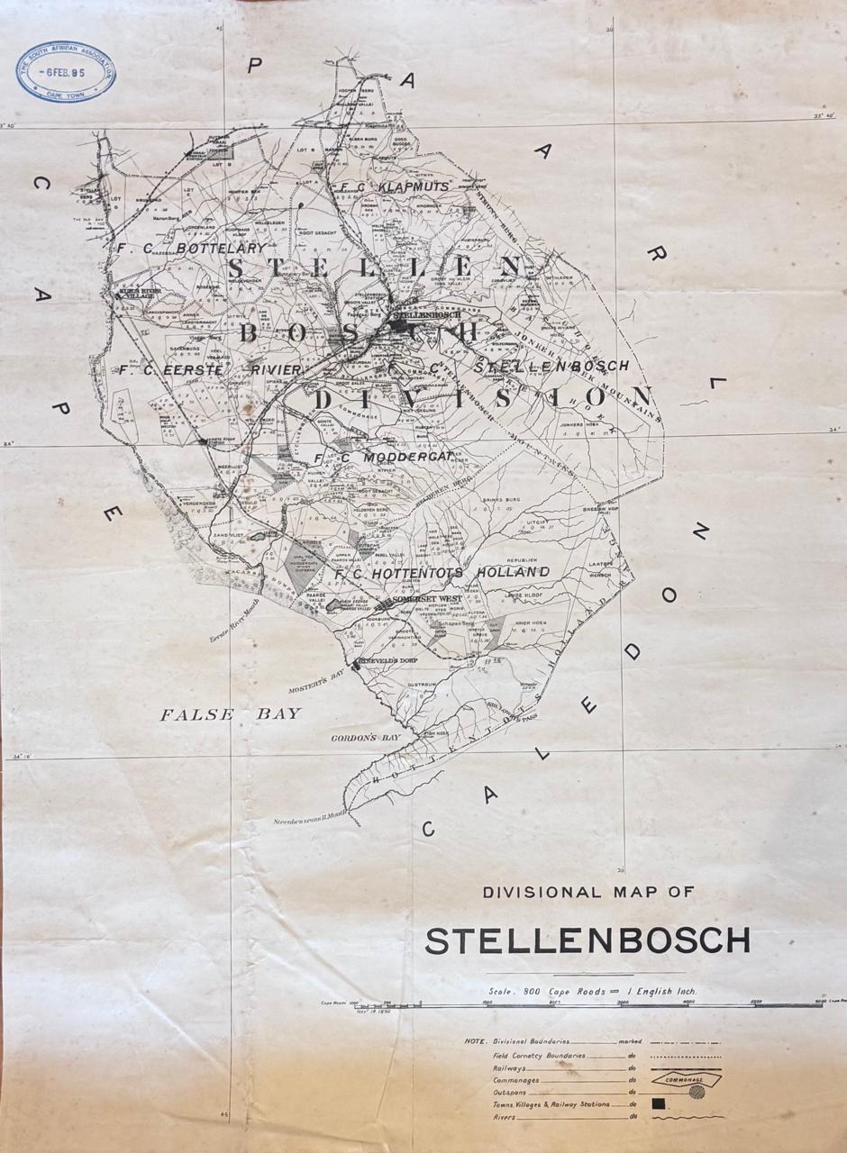
Divisional Map of Stellenbosch –
From Hoopen Berg in the North to Steenbras River Mouth. Shows farms: Meerlust, Zandvliet, Spier, Nooitgedacht, Zorgvliet, Blaauklippen and many more. Towns and villages – Stellenbosch, Kuilsriver, Somerset West, Ryneveld’s Dorp (The Strand), Fish Hoek (Gordon’s Bay). Size: 42 x 55cm. First Edition. Condition: Good. Publisher: Surveyor’s Office Date Published: 1890 Publication Place: Cape Town First Edition: Yes Condition: Good. Dimensions: 84cm x 103cm
AI Readiness
Good foundation, but some important product data is still missing.
72%